Missing Maps
The most crisis-prone parts of the world need mapping. With your help we can directly improve the lives of some of the planet’s most vulnerable people.
This is the aim of the Missing Maps, an open, collaborative initiative founded by Médecins Sans Frontières/Doctors Without Borders (MSF), the British Red Cross, the American Red Cross and the Humanitarian OpenStreetMap Team (HOT).
Volunteer mappers
Join the thousands of volunteers that are today already mapping the most vulnerable parts of the world; places that are at risk of natural disasters, disease outbreaks, epidemics or conflict.
The maps we create are available for use by everyone, everywhere, benefiting organisations like MSF and the Red Cross but also local people; helping them to have something so fundamental that most of the world takes for granted.
Missing Maps is being run through OpenStreetMap, which guarantees that the data collected and the maps that come from it are free, accessible and without restriction forever. Not only this, but the maps are live, meaning that anyone can add to, correct or develop them. Essentially, a Wikipedia of maps.

Become a humanitarian
By supporting the Missing Maps with your time, you can directly contribute to MSF's humanitarian medical activities.
We use maps every day to get to patients, to assess the needs of crisis-hit communities, to track disease spread and to respond to local events.
Currently, the maps non-governmental organisations (NGOs) like MSF use come in all shapes and sizes.
All NGOs collect geographical data of some sort, but you may be surprised to know that the maps we use are very often drawn on a piece of paper by someone who has been there.
By collaborating via the Missing Maps and uploading all the data we gather to OpenStreetMap, we can help build a detailed and useful map of the world that is so much more than the sum of its parts, meaning we can get to patients quicker, track diseases more effectively and better understand where the needs of the people are greatest following an emergency.
How can you help?
There are three stages in the Missing Maps process:
- Firstly, we need volunteers to trace the features of an area of interest. Using aerial photographs as a backdrop, we can literally trace road networks, buildings and landmarks to build a line drawing of the area.
- Next, we need people on the ground to collect the local names of neighbourhoods, roads, buildings, lakes, etc. This can be done by physically taking printed copies of maps created in step one, or by data collection on GPS devices or smartphones, and checking this information locally.
- Lastly, MSF and other humanitarian organisations can start using the mapped information in outbreak management, epidemiology, logistics and other activities that save lives.
The first stage of this process can be done by anyone, from anywhere with some dedication and training. You just need to sign up to OpenStreetMap and spend some time learning how to use the software. Once you are comfortable, you can start!

Mapathons
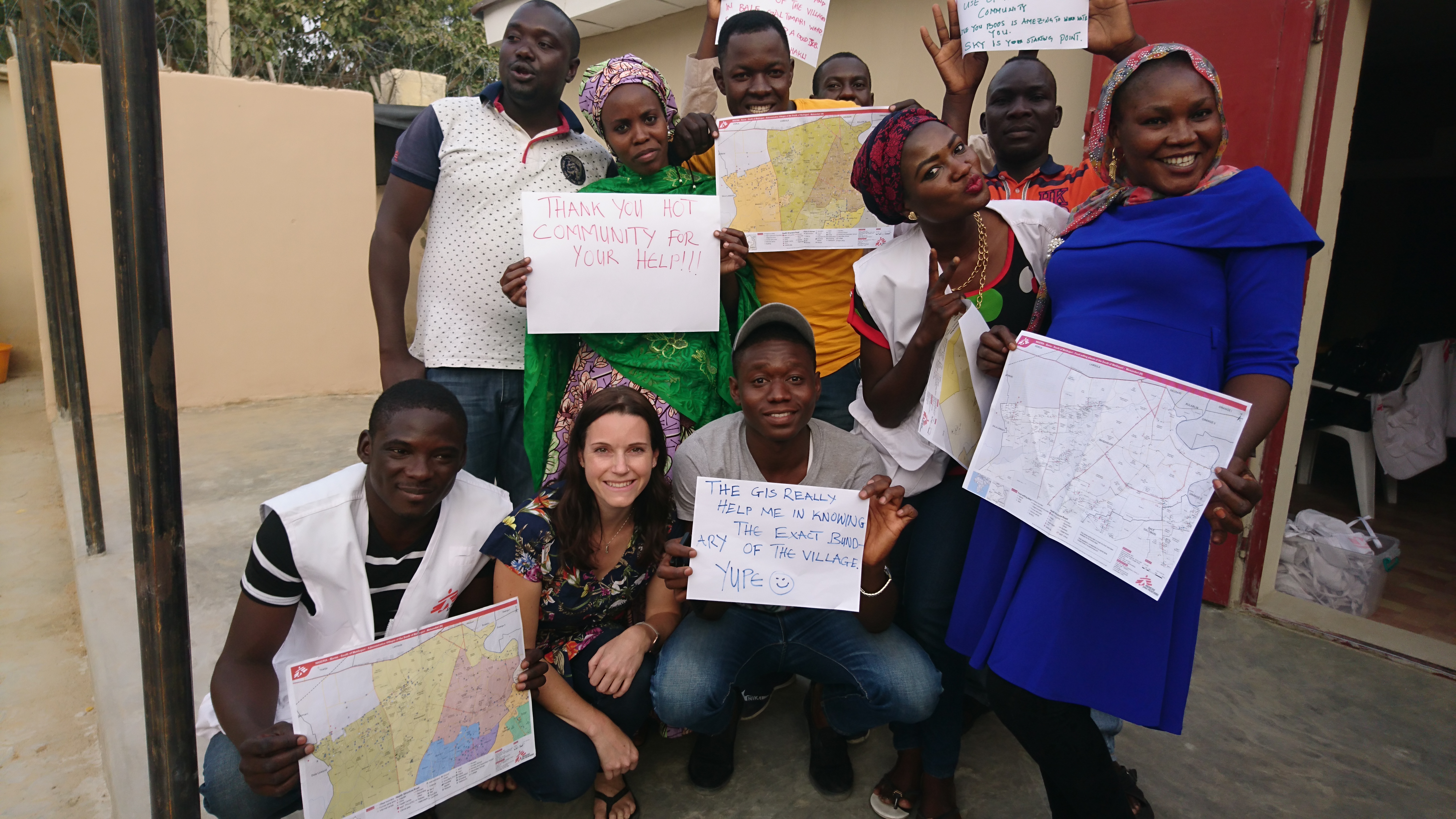
Alternatively, come to a mapathon where Missing Maps volunteers get together to map a wide geographical area all at once. (If you are under 18, you should be accompanied by an adult.)
During the mapathon, mapping experts will be on hand to help you get started and to answer any questions – it’s also a lot of fun! Our mapathons make a big impact in a very short space of time.
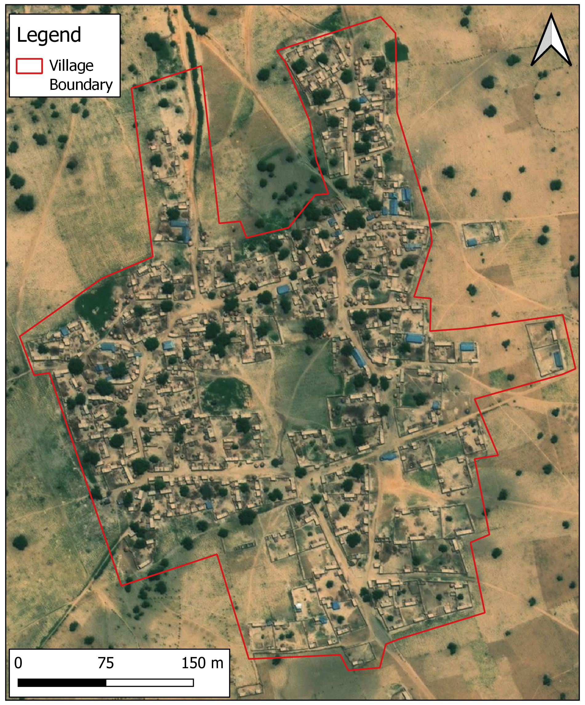
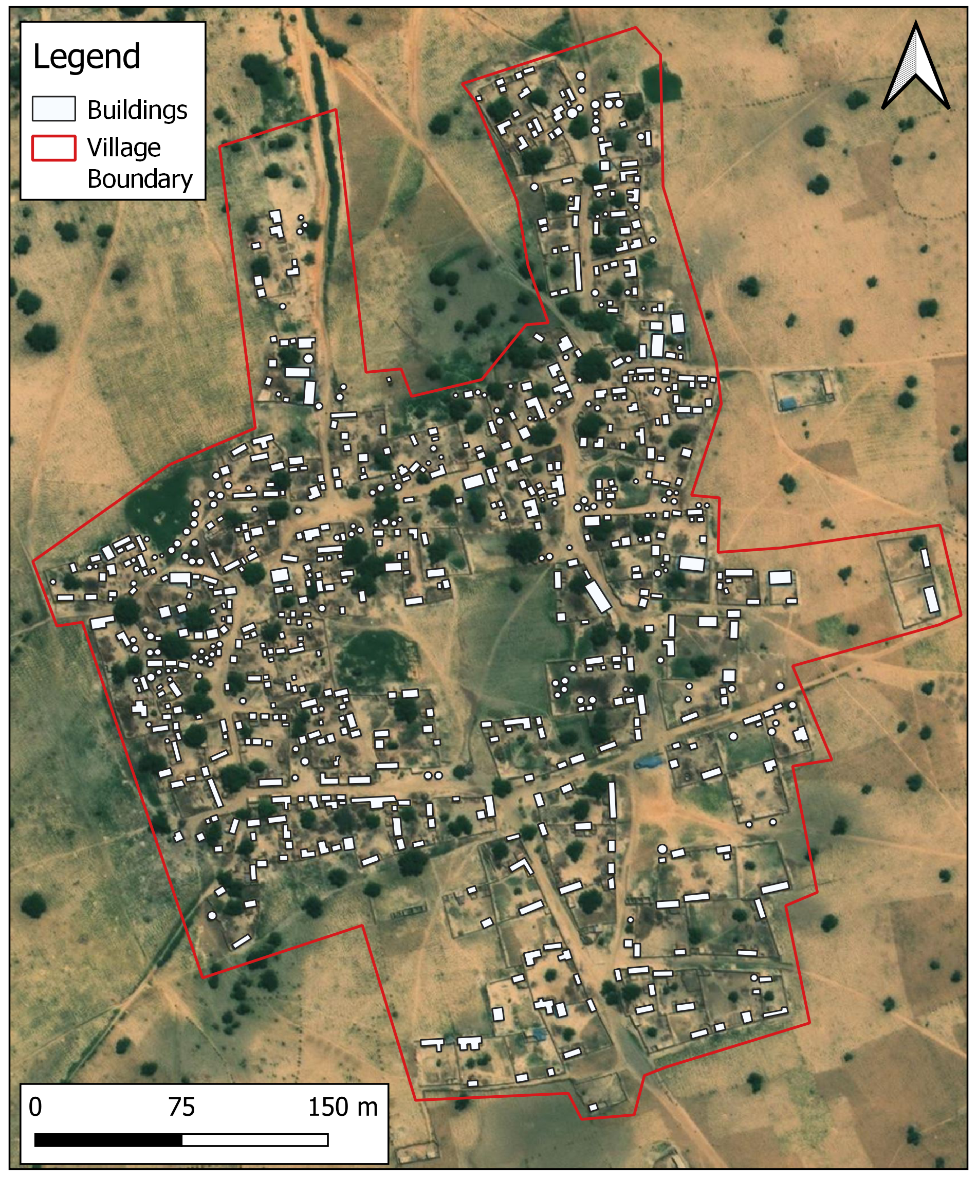
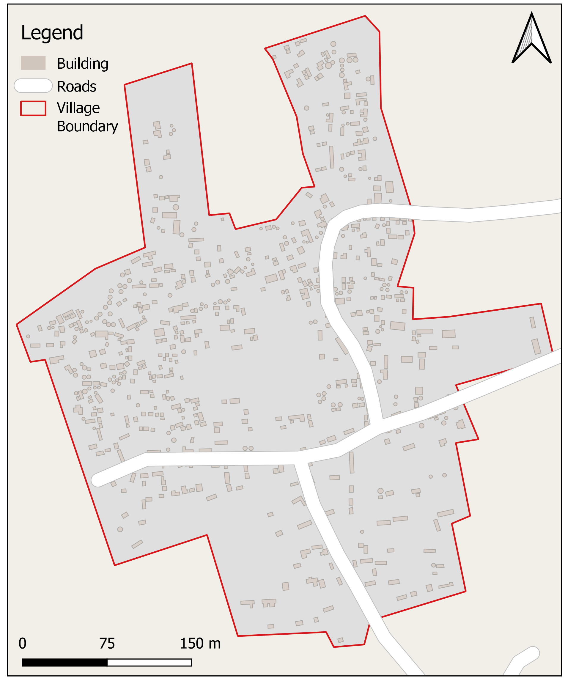
The following is an example of a village in northwest Nigeria on satellite imagery and OpenStreetMap, before and after mapping. This Missing Maps campaign was requested to identify villages and towns in remote locations to help manage noma, a neglected disease.
Before mapping
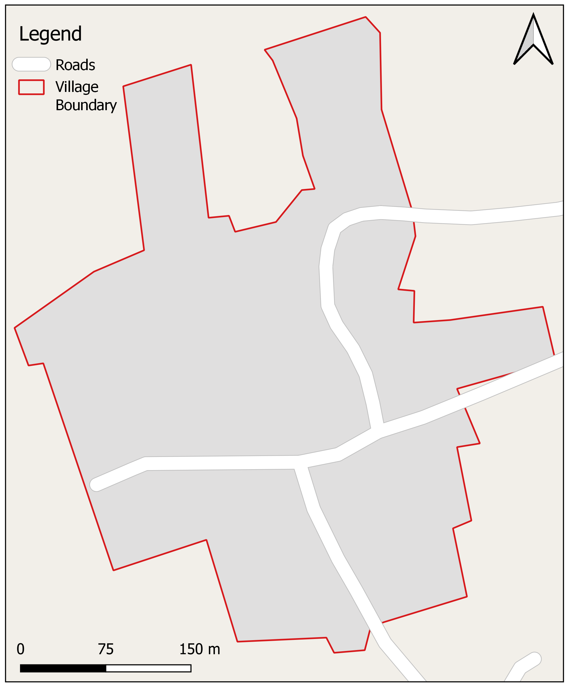
After mapping
How can you get involved?
Learn how to map and find out about mapathons around you on the Missing Maps website.
Alternatively, you could host your own mapathon if you are over 18. All you need is a space, a WIFI connection, some knowledge and willing friends (and snacks always go down well!).
Get in touch on Twitter, Facebook or Instagram if you have any questions or need any help with any of the above.
Missing Maps for universities and school groups
If you are studying for A-Levels, BTECs or GCSEs, in order to take part in The Missing Maps volunteering project at your school or college, we require that a teacher or member of staff leads the club and is able to check the mapping.
Universities, please get in touch to find out about resources for university groups and mapathons.
To find out more please contact: schools@london.msf.org
Thank you for joining us. Your collaboration in the Missing Maps will directly improve the lives of some of the most vulnerable people in the world.